Activities performed by the Section
The Section is acting as the National Mapping Agency for Mauritius. It produces and provides inter alia, accurate and up-to-date geographic data for use by the Government, members of the public and other stakeholders.
| v Preparation of high-quality thematic and customized maps; e.g. Township/Village Council/Constituency Map… |
|---|
| v Updating the Digital Cadastral Database (LAVIMS) for both State Land and Private Properties; |
|---|
| v Production of GIS data and provide expertise in Cartography and Geographic Information System (GIS); |
|---|
| v Processing request for permission to reproduce copyrighted maps; |
|---|
Sales of Maps
The Section is repository for a wide range of mapping products including historical aerial photographs and GIS data which are on sale both in soft and hard copy
v Topographic and Thematic maps
v Copies of Aerial Photographs dated as from 1967 to 2000 in black and white
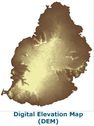
v Aerial Imagery and Digital Elevation Model (DEM) in ASCII format – Year 2008
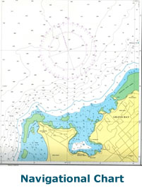
v Navigational Charts published by Indian National Hydrographic Office GIS Data
| 
|
|
|---|
List of Maps on Sale both in hard and soft copy
1/100,000 topographic map covering the whole island is available in one mapsheet.
1/25,000 scale topographic map covering the whole island in 13 map sheets.
1/5000 large scale maps. One map sheet covers an area of 6.48 km². (Preparation of these maps is in progress)
1/2,500 large scale maps - showing topographic data and contours at 2m interval (covering almost 2/3 of the island). One map sheet covers an area of 2km².
Thematic maps – (Constituency Map – Health Map ….)
Maps of Administrative Boundaries. (District, District Council, Municipal Council, Village Council & Constituency Maps)
Street maps of the City and Towns
Outer islands – Rodrigues /Agalega
Navigational charts
The following Navigational charts published by the Indian National Hydrographic Office are available in hard copies only at 33 USD.
Sr. No. | Sheet No. | Sheet Description | Date Published |
1 | 2503(INT 77391) | Approaches to Cargados and Carajos Shoals | Dec/2016 |
2 | 2504(INT 77392) | Mathurin Harbour | Dec/2020 |
3 | 2505(INT 77393) | Approaches to Mathurin Harbour | Dec/2020 |
4 | 2506(INT 77394) | Grand Bay and Grand Rivière Noire Bay | Jan/2017 |
5 | 2507(INT 77395) | Grand Port | Feb/2020 |
6
| 2508
| Agalega Jetty
| Mar/2023
|
7 | 2512(INT 77396) | Agalega Islands | Oct/2023 |
8 | 2514(INT 7739) | Port Louis and Approaches | Oct/2018 |
9 | 2527(INT77397) | Mauritius | Aug/2023 |
10 | 2529(INT 7601)
| Northerin Islets of Mauritius
| Aug/2023 |
11
| 2530(INT 7602)
| Approaches to Grand Port
| Aug/2023
|
Digital Data Products For the purchase digital data product, purchaser is required to fill in an Application Form and sign a Sale Agreement Contract in duplicate in order to safeguard the Government copyright. The Application, the Sale Agreement Contract and price list of all digital products can be downloaded from the website of the Ministry.
Various types of maps in vector are available in AutoCAD or .dxf format.
Aerial Photographs scanned at required resolution in jpeg format.
Aerial Imagery Year 2008 @ 15cm resolution
GIS mapping data (Shapefile format)
The following documents may be downloaded from the website of the Ministry:
 Price list of Constituency Map (2024 Edition 5)
Aerial Photographs
Permission to use maps copyrighted to the Republic of Mauritius
Request to use copyrighted maps in any publication should be made to the Permanent Secretary of the Ministry. Permission is granted against payment of an approved fee.
Queries
We will respond to your Telephone and Fax queries within three working days.
Contact
The above information is of general nature, for more details please contact the cartography section during office hours: