Documentation of how to use the web mapping showing the Public beaches and Access to the Sea
Prepared by the Chief Cartographer - Cartography Section -Survey Division
Ministry of Housing and Lands
Ebene Tower, Plot 52, Ebene
September 2026
Ministry of Housing and Lands Home Page

![]()

A List of Layers/ information will be Displayed
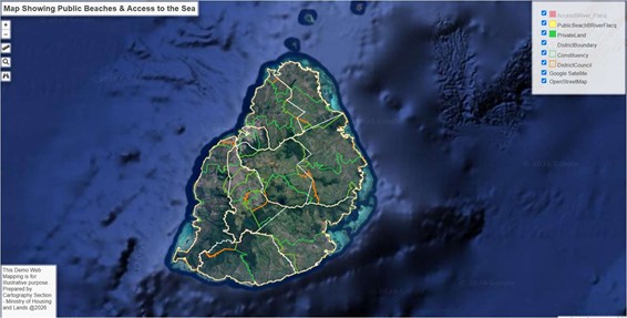
Users can toggle between layers as per user requirement

Search for any other places is also available using another search tool

Note Open streetmap is also available in the list of layers to better navigate across Mauritius

Click on the public beach – info about the public beach will be popup

Click on the Access to the beach – a popup window will be displayed showing information about the corresponding access

Some Useful tools